

Features
Details
Introducing the Tennessee State Wall Map, the perfect addition to your home or office decor. This 20.75" x 18.5" laminated map is not just another basic map - it's a comprehensive guide to navigating the beautiful state of Tennessee. With its easy-to-read design, you'll have no trouble finding all major thoroughfares, secondary roads, freeway interchanges, and more. Its vibrant colors and detailed features will undoubtedly enhance your understanding and appreciation of Tennessee's geography.
What sets this state map apart is its inclusion of shaded relief, providing a three-dimensional depiction of Tennessee's topography. You'll be able to visualize the state's mountains, valleys, and other natural features, giving you a deeper understanding of its unique landscape. Whether you're a nature enthusiast, a history buff, or just someone curious about the world around them, this map will not disappoint.
Additionally, our Tennessee State Wall Map includes detailed city inset maps of Chattanooga, Knoxville, Memphis, and Nashville. These insets are based on the latest street information, ensuring you have the most up-to-date guidance when navigating through these vibrant cities. Plus, with the county and city indices conveniently provided, you'll be able to locate even the smallest towns effortlessly.
What sets our maps apart is the commitment to quality and accuracy. Produced by Globe Turner, one of the leading map producers in the USA, you can trust that this Tennessee State Wall Map is of the highest standard. The laminated finish also ensures durability, protecting your investment for years to come.
Don't miss out on the opportunity to own this exceptional Tennessee State Wall Map. Enhance your knowledge, explore the state's magnificent landscapes, and plan your next adventure with ease. Order now and take advantage of our special offer.Click here to purchase your Tennessee State Wall Map today!
Discover More Best Sellers in Maps
Shop Maps

 Maps - National Geographic World Wall Map - Executive - Laminated (Enlarged: 73 x 48 in) (National Geographic Reference Map)
 Maps - Flat Earth Maps SET OF 2 MAPS- Flat Earth Map - 24" x 36" Gleason's New Standard Map Of The World | 24" x 18" Map of the Square and Stationary Earth by Orlando Ferguson (1)
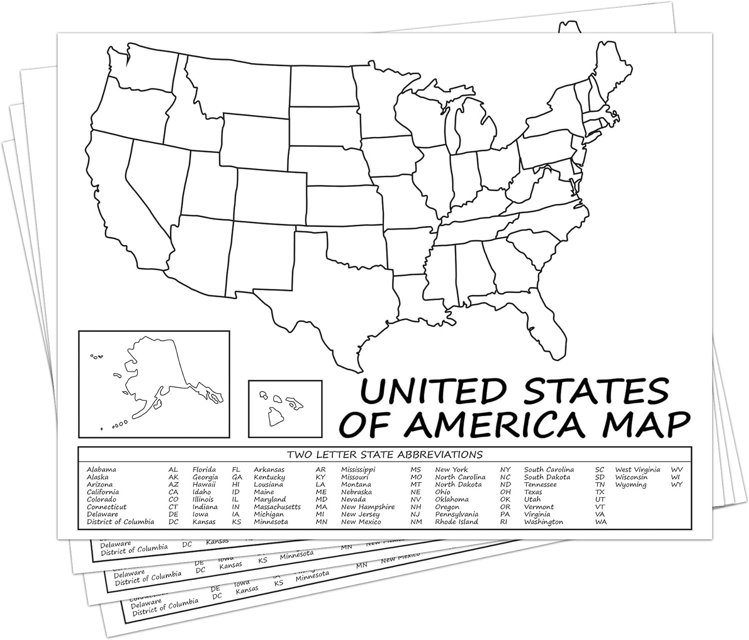 Maps - United States Map - USA Poster, US Educational Map - with 2 Letter State Abbreviation - for Ages Kids to Adults - Home School Office | Printed on 110Lb Card Stock - 8.5 x 11" Inches - Bulk Pack of 10
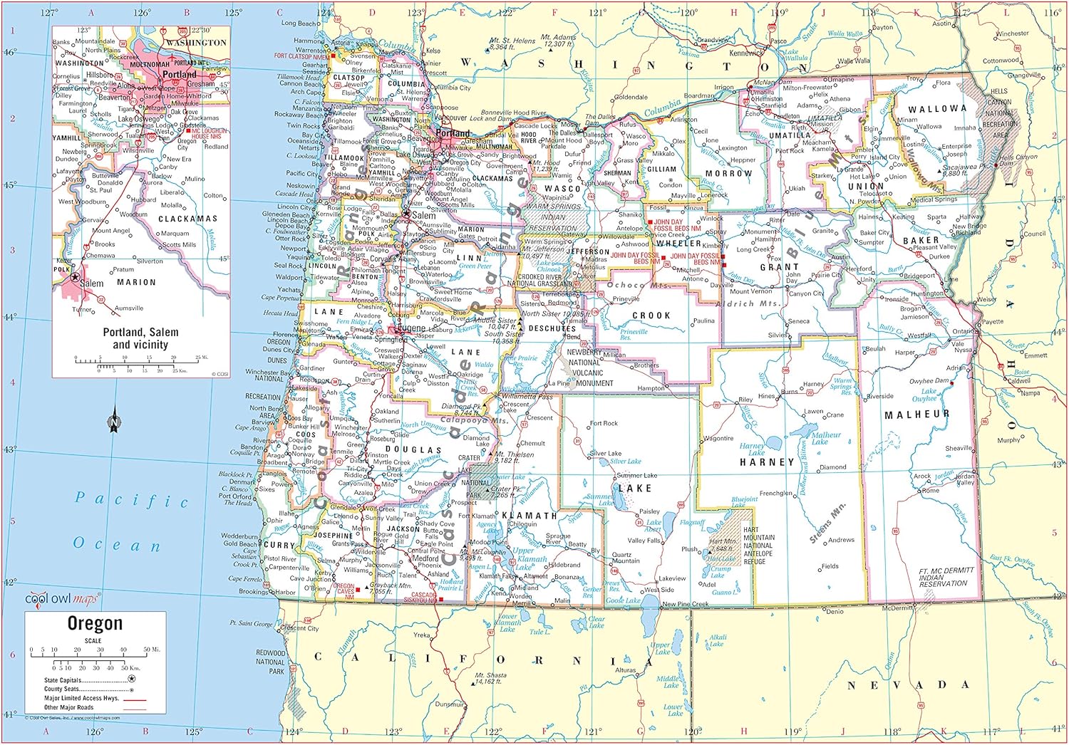
Cool Owl Maps Oregon State Wall Map Poster Rolled (Paper 34"x24")
Maps - Cool Owl Maps Oregon State Wall Map Poster Rolled (Paper 34"x24")

ArtCantHurtU 1595 Flat Earth Map of North Pole Art Poster | Septentrionalium Terrarum (23"x24.5")
Maps - ArtCantHurtU 1595 Flat Earth Map of North Pole Art Poster | Septentrionalium Terrarum (23"x24.5")
 Maps - Epic Adventure Maps US National Parks Scratch Off Poster, National Park Posters Reveals Pine Shaped Nature Photographs, Beige, 24 x 17 Inches
 Maps - Laminated World Odyssey Map Poster | Executive Style Map | Includes The Most Legible Location Labels | 36” x 24” | Shipped Rolled in a Tube, Not Folded | Great for The Home or Classroom

 Maps - National Geographic: Countries of the Mediterranean Classic Wall Map - 30.25 x 23.5 inches - Art Quality Print

