

Description
Book Synopsis: Rand McNally's Easy To Read State Folded Maps are a must-have for anyone traveling in and around these states, offering unbeatable accuracy and reliability at a great price. Their trusted cartography shows all Interstate, U.S., state, and county highways, along with clearly indicated parks, points of interest, airports, county boundaries, and streets. The easy-to-use legends and detailed indexes make for quick and easy locations of destinations. Rand McNally folded maps have been the trusted standard for years.
Details
Looking for accurate and reliable maps of Oklahoma and Texas? Look no further than Rand McNally's Easy To Read State Folded Maps. Whether you're a frequent traveler or just planning a short trip, these maps are a must-have companion. Designed with precision and priced affordably, these maps offer unbeatable quality at a great value.
Why settle for outdated or unreliable maps when you can have the trusted cartography of Rand McNally? Our maps show all Interstate, U.S., state, and county highways, ensuring you never miss a turn. With clearly indicated parks, points of interest, airports, county boundaries, and streets, you'll always have the confidence to explore these states to the fullest.
Don't waste time searching for your destination. Our easy-to-use legends and detailed indexes make it a breeze to find what you're looking for. Whether you need directions to a specific address or want to discover nearby attractions, our maps have got you covered. No more fumbling with unclear directions or relying on unreliable GPS systems – Rand McNally folded maps have set the standard for accuracy and ease of use for years.
Ready to embark on your next adventure in Oklahoma and Texas? Get your hands on Rand McNally's Easy To Read State Folded Maps and experience the best in cartography. Don't miss out on this unbeatable offer – order now and start exploring these states like never before!
Order now and start your journey with confidence!
Discover More Best Sellers in Maps
Shop Maps
Rand McNally Easy to Read: West Virginia State Map
 Maps - Rand McNally Easy to Read: West Virginia State Map

Pacon PAC78760 United States Giant Map, 48" Width, 72" Length, Black/White
 Maps - Pacon PAC78760 United States Giant Map, 48" Width, 72" Length, Black/White

 Maps - Conquest Maps World Map Poster Modern World Map Style Decor to Track Your Travels & Pin Your Adventures! Matte Poster Paper Detailed Graphics -Cities States & Countries - 2015 Data (24 x 16 Inches)
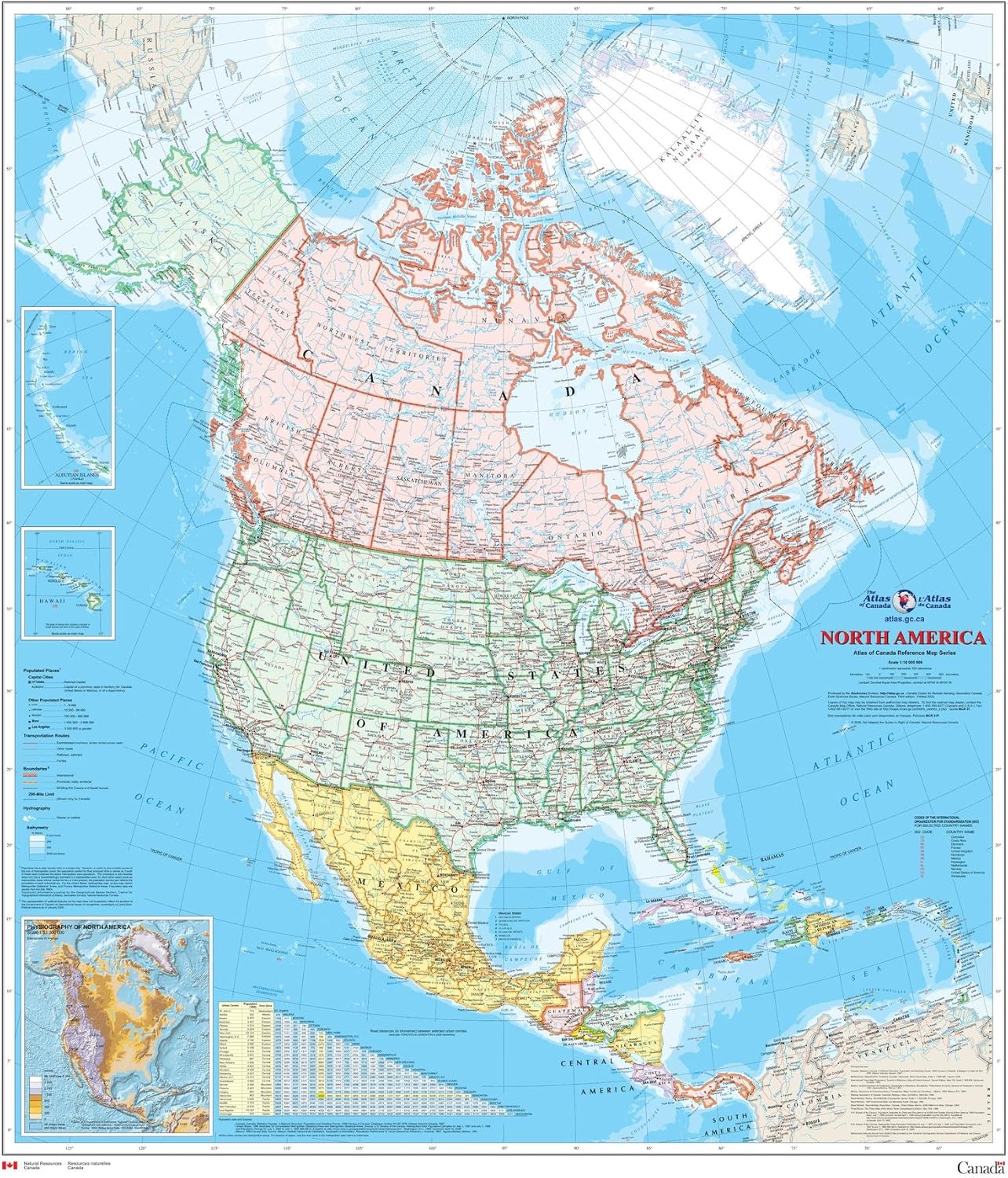
North America Wall Map - Atlas of Canada - 34" x 39" Paper
Maps - North America Wall Map - Atlas of Canada - 34" x 39" Paper

Pacific-Centered World Wall Map - 61" x 33.5" Laminated
Maps - Pacific-Centered World Wall Map - 61" x 33.5" Laminated

Time Zone Wall Map of The World - Large - 56.25" x 34.75" Paper
Maps - Time Zone Wall Map of The World - Large - 56.25" x 34.75" Paper
 Maps - Gifts Delight Laminated 24x28 Poster: Political Map - Maps of India Detailed map of India in English Tourist map of India Road map of India

Gifts Delight Laminated 24x24 Poster: Political Map - Map China
 Maps - Gifts Delight Laminated 24x24 Poster: Political Map - Map China

