
Features
Details
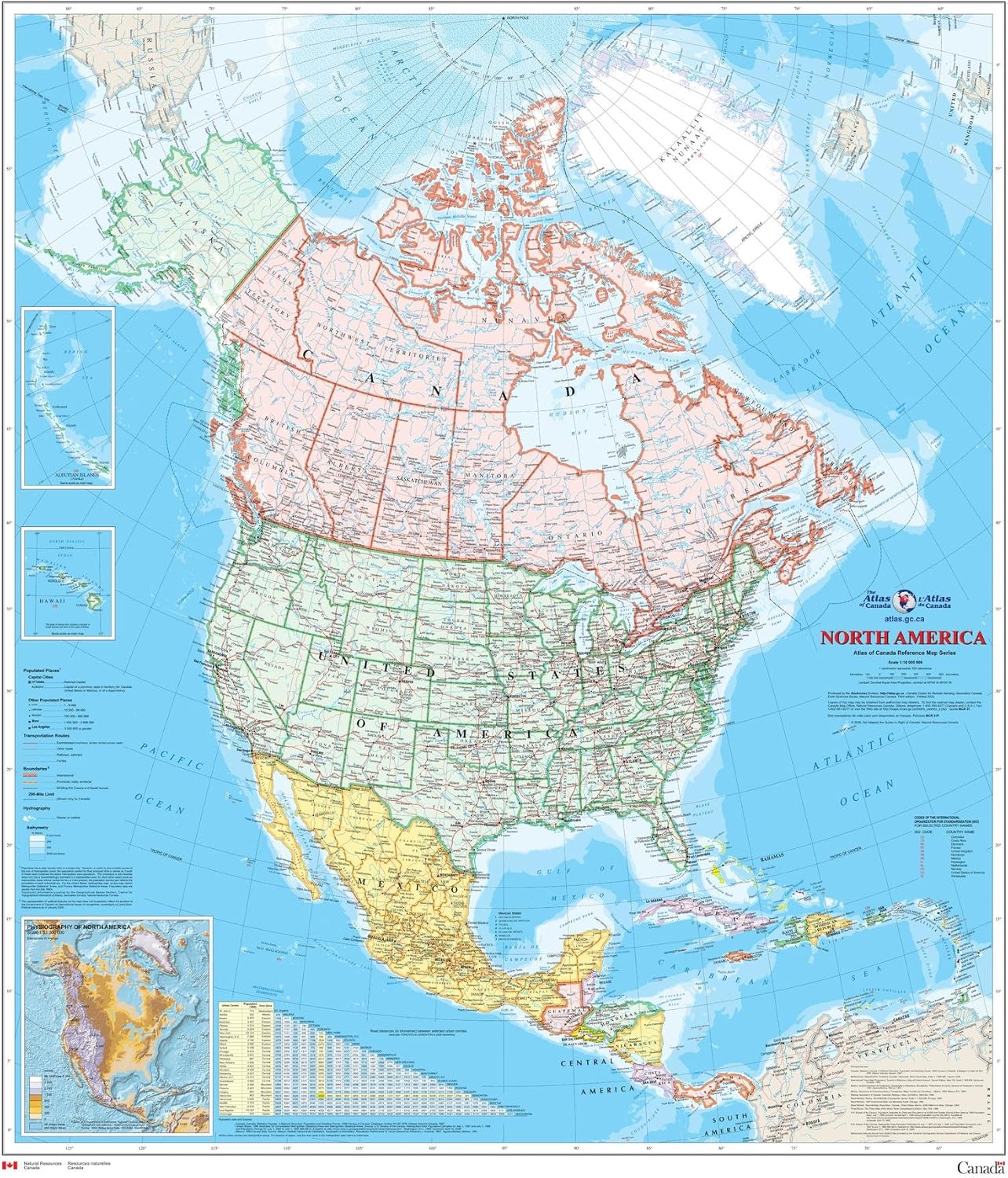
Looking to explore the vast beauty of North America? Look no further than our North America Wall Map - Atlas of Canada! Measuring 34" x 39" and printed on high-quality paper, this map is perfect for anyone seeking to uncover the hidden gems of this magnificent continent. Whether you're planning a road trip or simply want to enhance your geographical knowledge, our detailed and informative map is an essential tool.
With a scale of 1:10,000,000, our map provides a comprehensive view of North America, showcasing not only the major cities and transportation routes but also the intricate drainage network. The bright colors used to represent individual countries and dependencies make it easy to distinguish and explore different regions and territories. Plus, the inclusion of three inset maps highlighting the Aleutian Islands, Hawaii, and the relief of North America with significant mountain elevations adds an extra level of detail and excitement to your exploration.
What sets our map apart from others is the table of road mileages between major cities. This feature is incredibly useful for planning road trips, allowing you to estimate travel times and distances accurately. No more guesswork or relying on outdated information - our map provides you with the most up-to-date data to ensure a smooth and efficient journey.
Take the first step in your North American adventure and order our North America Wall Map - Atlas of Canada now. Simply click the link below to purchase your map and embark on a journey of discovery.
Discover More Best Sellers in Maps
Shop Maps
 Maps - UK Map - Classic Wall Map Of The United Kingdom Poster - Front Lamination, UK Map - Classic Wall Map Of The United Kingdom Poster - Front Lamination - 33 x 23in

Walt Disney World Resort 4 Theme Parks Downtown Springs Vacation Planning Guide Maps
 Maps - Walt Disney World Resort 4 Theme Parks Downtown Springs Vacation Planning Guide Maps

Close Up World map XXL Poster Vintage 2018- MAPS in Minutes® (55"x39")
Maps - Close Up World map XXL Poster Vintage 2018- MAPS in Minutes® (55"x39")

24x36 World Wall Map by Smithsonian Journeys - Blue Ocean Edition Laminated (24x36 Laminated)
Maps - 24x36 World Wall Map by Smithsonian Journeys - Blue Ocean Edition Laminated (24x36 Laminated)
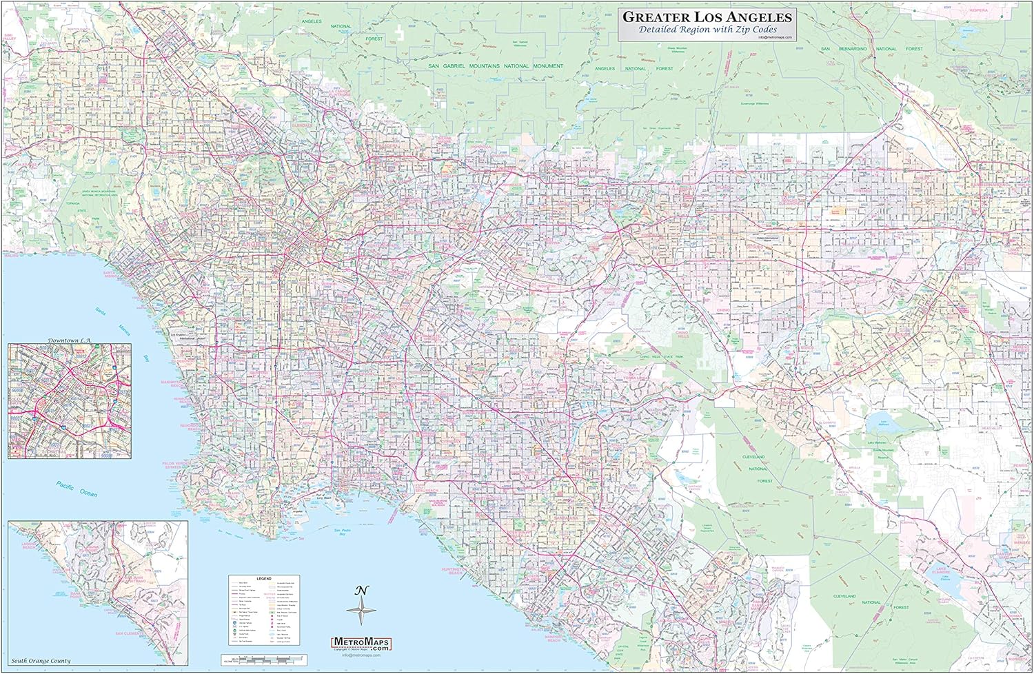
Los Angeles-Orange County-Riverside Detailed Region Wall Map (67"x44") w/Zip Codes (Laminated)
 Maps - Los Angeles-Orange County-Riverside Detailed Region Wall Map (67"x44") w/Zip Codes (Laminated)

Maps International Medium Political Middle East Wall Map - Paper - 27 x 33
Maps - Maps International Medium Political Middle East Wall Map - Paper - 27 x 33
 Maps - Laminated Piri Reis 1513 Historical World Map Travel World Map with Cities in Detail Map Posters for Wall Map Art Wall Decor Geographical Illustration Travel Destinations Poster Dry Erase Sign 24x36
 Maps - America The Beautiful USA Scratch Off Map- Interactive Travel Map - Scratch Off Poster Reveals Beautiful Nature Photography of Each 50 States - Travelers Gift - Traveler Wall Decor

