

Features
Related lessons and activities are provided on the back of every chart. Each chart measures 17 x 22 Inches. Shiny, protective coating for durability
Details
Enhance your students' geography knowledge with the Teacher Created Resources North America Map Chart. Designed with vibrant colors, this chart will captivate their attention and make learning fun. With related lessons and activities conveniently provided on the back of the chart, you'll have everything you need to create engaging lessons that reinforce important concepts.
Measuring at a perfect size of 17 x 22 inches, this map chart is large enough to be seen from anywhere in the classroom. Hang it on the wall or display it on an easel for easy access during lessons and discussions. Its eye-catching design and clear labeling of countries, capitals, and major landmarks will help your students develop a solid understanding of North America's geography.
Durability is essential when it comes to educational materials, and the Teacher Created Resources North America Map Chart delivers. The chart is coated with a shiny, protective layer that not only adds a professional touch but also ensures its longevity. Say goodbye to charts that tear easily or lose their vibrant colors over time. Invest in a high-quality chart that will serve your classroom for years to come.
Take your geography lessons to the next level with the Teacher Created Resources North America Map Chart. It's a comprehensive tool that engages students, provides essential information, and withstands the test of time. Don't miss out on this opportunity to enhance your teaching and make geography come alive for your students. Get your chart today and unleash the power of hands-on learning. Click here to order now!
Discover More Best Sellers in Geography Materials
Shop Geography Materials
Rand McNally Easy to Read: Connecticut, Rhode Island State Map
 Geography Materials - Rand McNally Easy to Read: Connecticut, Rhode Island State Map

Rand McNally Easy to Read: West Virginia State Map
Geography Materials - Rand McNally Easy to Read: West Virginia State Map

Authentic Models, Traveler's World Globe In Box, Decorative Globe
 Geography Materials - Authentic Models, Traveler's World Globe In Box, Decorative Globe
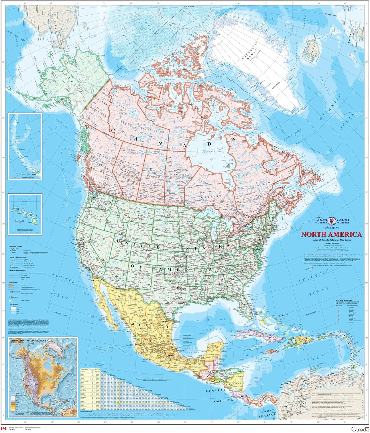
North America Wall Map - Atlas of Canada - 34" x 39" Paper
Geography Materials - North America Wall Map - Atlas of Canada - 34" x 39" Paper

Cool Owl Maps Utah State Wall Map Poster Rolled 24"Wx30"H (Laminated)
Geography Materials - Cool Owl Maps Utah State Wall Map Poster Rolled 24"Wx30"H (Laminated)

Cool Owl Maps New York State Wall Map Poster Rolled 24"Wx30"H (Laminated)
Geography Materials - Cool Owl Maps New York State Wall Map Poster Rolled 24"Wx30"H (Laminated)
 Geography Materials - Large Blue Ocean World Wall Map | 36x24 - Detailed World Wall Map | 2020 World Map Poster - Non-Laminated World Map | Academia Maps
 Geography Materials - Wizdar 4'' World Globe for Kids Learning, Educational Rotating World Map Globes Mini Size Decorative Earth Children Globe for Classroom Geography Teaching, Desk and Office Decoration-4 inch
 Geography Materials - Hambli World Map For Wall – 37” x 26” Large Map of the World Poster - World Map Wall Art For Classroom, Kids & Travel
