

Discover More Best Sellers in Maps
Shop Maps


 Maps - Gall Orthographic World Map | Most Accurate World Map - Countries are Shown in Correct Proportion to Each Other | Laminated World Map | 36” x 24”
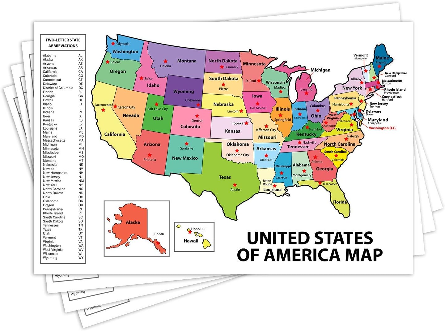 Maps - United States Map - USA Poster, US Educational Map - With State Capital - for Ages Kids to Adults- Home School Office - Printed on 12pt. Glossy Card Stock | Bulk Pack of 10 | 12 x 18 Inches

50 States USA Photo Map - Frame Optional - Made in America (Printed Map, White Frame)
Maps - 50 States USA Photo Map - Frame Optional - Made in America (Printed Map, White Frame)

Laminated World Map Poster - Wall Chart Map of Earth - 18" x 29" (Blue)
Maps - Laminated World Map Poster - Wall Chart Map of Earth - 18" x 29" (Blue)

Wall Art Impressions 36"x24" Map of Massachusetts Cities, Towns and County Seats【Laminated】
 Maps - Wall Art Impressions 36"x24" Map of Massachusetts Cities, Towns and County Seats【Laminated】

Benchmark Maps: Baja California Peninsula Wall Map - 25 x 39 inches
Maps - Benchmark Maps: Baja California Peninsula Wall Map - 25 x 39 inches

South Korea Physical Poster Map - 23.3 x 16.5 Inches - Paper Laminated
Maps - South Korea Physical Poster Map - 23.3 x 16.5 Inches - Paper Laminated
