Features
Set of 2 Posters Made in the USA Map posters are 18" x 29” in size
High-quality 3 MIL lamination for added durability
Tear Resistant
Details
Looking for the perfect educational tools to inspire your child's love for geography? Look no further! Introducing our 2 Pack World Map and Blue Ocean USA Map posters, designed to captivate your little one's imagination and provide them with a solid foundation in geographical knowledge. These posters are not only visually stunning, but they're also made to last with high-quality 3 MIL lamination, making them tear resistant and durable for years to come.
As a parent, you understand the importance of investing in educational resources that will stand the test of time. Our World Map for Kids and Blue Ocean USA Map posters are proudly made right here in the USA. We believe in supporting local businesses and ensuring that our products meet the highest standards of quality. With their vibrant colors and clear labeling, these posters will make learning geography an enjoyable and engaging experience for your child.
In a world that is becoming increasingly interconnected, it's crucial for children to have a solid understanding of geography. Our 2 Pack World Map and Blue Ocean USA Map posters provide a comprehensive view of the world, allowing your child to explore continents, countries, and oceans with ease. Whether you're homeschooling, supplementing classroom learning, or simply looking for educational materials to enrich your child's knowledge, these posters are the ultimate learning tools that will spark curiosity and inspire a love for the world around them.
Don't miss out on this incredible offer! Enhance your child's learning experience and create a stimulating environment for their growth and development. Order our 2 Pack World Map and Blue Ocean USA Map posters today and take advantage of our limited-time discount. Click here to place your order now!
Discover More Best Sellers in Maps
Shop Maps

Butler Maps G1 Regional Maps (Northern Mid-Atlantic States)

 Maps - Butler Maps G1 Regional Maps (Northern Mid-Atlantic States)
 Maps - Great Smoky Mountains National Park East: Clingmans Dome, Cataloochee Map (National Geographic Trails Illustrated Map, 317)
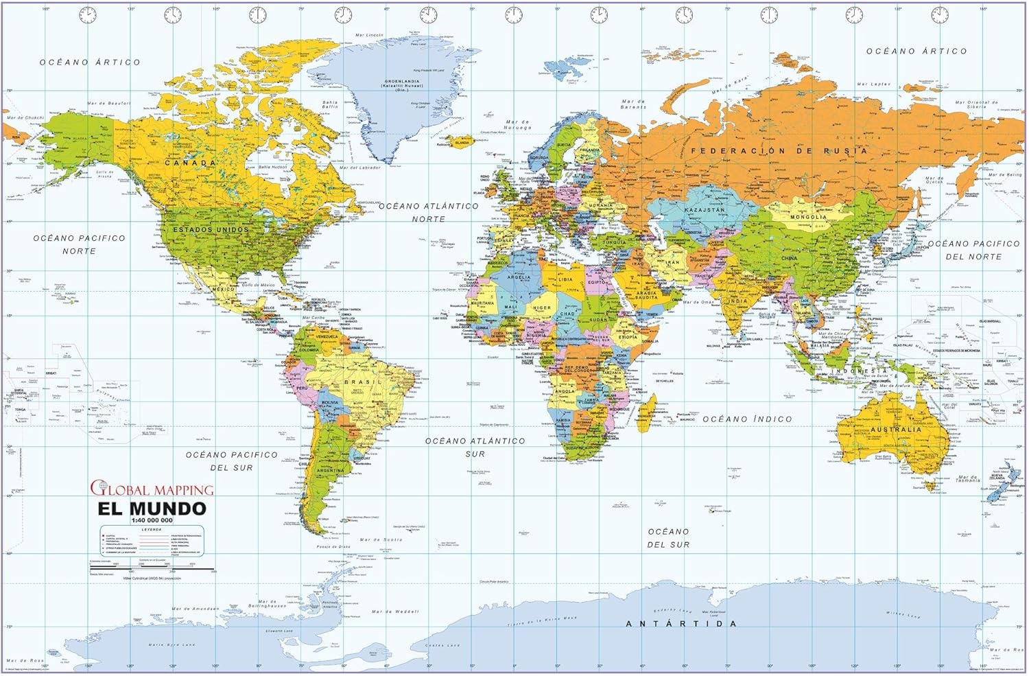 Maps - Political World Wall Map, Spanish Language, Mapa político del mundo, idioma español - 40.75 x 27 inches - Paper - Flat Tubed

Cool Owl Maps Washington State Wall Map Large Print Poster Rolled (Laminated 34"x24")
Maps - Cool Owl Maps Washington State Wall Map Large Print Poster Rolled (Laminated 34"x24")

Map Gleason 1892 World Time Calculator Flat Earth Art Print Framed Poster Wall Decor 12x16 inch
Maps - Map Gleason 1892 World Time Calculator Flat Earth Art Print Framed Poster Wall Decor 12x16 inch

 Maps - National Geographic: Vietnam, Cambodia, Laos and Eastern Thailand 1965 - Historic Wall Map Series - 11.25 x 20.5 inches - Laminated

Cool Owl Maps Pennsylvania State Wall Map Poster Rolled 34"Wx24"H (Laminated)
Maps - Cool Owl Maps Pennsylvania State Wall Map Poster Rolled 34"Wx24"H (Laminated)