
Features
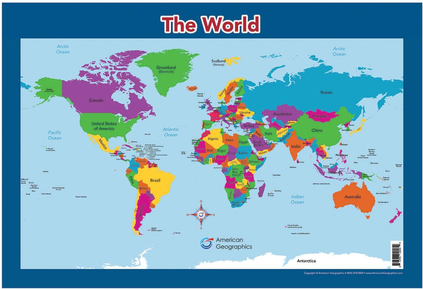
WORLD MAP: This map features the political world in clear and lively pastel colors and presents the most current geographical and cartographical data available.
MAPS FOR KIDS: These maps are designed in a minimalist manner to offer kids and young students basic and clear display the countries of the world in the World map the continental United States (USA) with clear inserts for Hawaii and Alaska in the USA map.
SIZE AND SHIPPING: The exact measurements of the laminated map are 26" x 17 ¾". The map is rolled up into a plastic sleeve and shipped in a tube.
MADE IN USA: The designs, printing, and lamination are all done in the United States by Lighthouse Geographics.
Details
Looking for the perfect tool to teach your children about the world? Look no further than our World Map for Kids! This map features clear and lively pastel colors, making it visually appealing and engaging for young minds. With the most up-to-date geographical and cartographical data, your kids will be able to explore and learn about different countries and continents. It's the perfect educational resource to spark their curiosity and broaden their horizons.
Designed specifically with kids and young students in mind, our maps are minimalist in style, allowing for a basic and clear display of the countries of the world. Additionally, the map includes clear inserts for Hawaii and Alaska in the USA map, ensuring comprehensive coverage of the continental United States (USA). Your children will be able to effortlessly navigate and understand the different regions of the world with ease.
Measuring at 26” x 17 ¾”, our laminated map is the perfect size to fit on your child's wall or desk. Its durable lamination ensures long-lasting use, allowing your child to refer to it time and time again. For added convenience, the map is rolled up into a plastic sleeve and shipped in a tube, ensuring it arrives in pristine condition.
Support locally made products and rest assured that our map is proudly made in the USA. All the designs, printing, and lamination are done right here by Lighthouse Geographics, ensuring exceptional quality that you can trust. Experience the joy of seeing your child explore and learn with our World Map for Kids.
Ready to take your child's geographical knowledge to the next level? Order your World Map for Kids today and embark on an educational adventure like never before. Click here to place your order now!
Discover More Best Sellers in Maps
Shop Maps

World Map Classic Style - Front Sheet Lamination - Cartographic Detail (A0 33 (h) x 47 (w) inches)
 Maps - World Map Classic Style - Front Sheet Lamination - Cartographic Detail (A0 33 (h) x 47 (w) inches)

 Maps - Carson Dellosa Blank Jumbo US Map Set—Large United States Map Sheets With List of U.S. States and Capitals, United States of America Geography (30 pc)

24x36 World Classic Premier Wall Map Poster (Laminated)
Maps - 24x36 World Classic Premier Wall Map Poster (Laminated)

Gifts Delight Laminated 24x31 Poster: Map of Vietnam
Maps - Gifts Delight Laminated 24x31 Poster: Map of Vietnam

XXL USA Map Premium Poster Giant America Map with all States 55" x 39" MAPS IN MINUTESÙ (55"x39")
Maps - XXL USA Map Premium Poster Giant America Map with all States 55" x 39" MAPS IN MINUTESÙ (55"x39")

Cool Owl Maps Iowa State Wall Map Poster Rolled 34"Wx24"H (Laminated)
Maps - Cool Owl Maps Iowa State Wall Map Poster Rolled 34"Wx24"H (Laminated)

National Geographic World Classic Political Wall Map - 36 x 24 inches - Art Quality Print
Maps - National Geographic World Classic Political Wall Map - 36 x 24 inches - Art Quality Print

