

Features
UK State Countries colored with banded boundaries Major cities ranked by population, National Parks and Airports All current Information - revised for 2020 ☺Made/Printed in U.S.A.
Details
Increase your knowledge and explore the rich history and beauty of the United Kingdom and Ireland with our Cool Owl Maps Wall Map Poster. This 24"x27" poster is expertly rolled and printed on high-quality paper, ensuring durability that will last for years to come. With the UK state countries clearly marked and colored with banded boundaries, you'll be able to easily identify and understand the various regions.
What sets our wall map poster apart is the inclusion of major cities ranked by population. This invaluable information allows you to quickly grasp the size and significance of each city, giving you a deeper understanding of the cultural and economic landscape of the UK. Whether you're a history buff, a geography enthusiast, or simply curious about our neighboring countries, this poster will provide you with a comprehensive overview.
Plan your future adventures with ease, as our map also highlights the location of national parks and airports. Whether you're looking to hike through the breathtaking landscapes or jet off to a new destination, our map will help you stay informed and make informed decisions. Plus, with all the information being revised for 2020, you can trust that you're getting the most up-to-date details available.
As a testament to our commitment to quality, every Cool Owl Maps Wall Map Poster is proudly made and printed in the U.S.A. We strive to provide you with the highest level of craftsmanship and accuracy, ensuring that you receive a product that exceeds your expectations. Don't settle for generic maps that lack depth and detail – choose our United Kingdom and Ireland Wall Map Poster and embark on a journey of knowledge and discovery.
Ready to explore the United Kingdom and Ireland like never before? Order your Cool Owl Maps Wall Map Poster now and unravel the mysteries of these captivating countries!Order now.
Discover More Best Sellers in Maps
Shop Maps

24x36 United States, USA Classic Elite Wall Map Mural Poster (Laminated)
 Maps - 24x36 United States, USA Classic Elite Wall Map Mural Poster (Laminated)

Flat Earth Map - Map of the Square and Stationary Earth -Orlando Ferguson- Poster 24" x 18"
Maps - Flat Earth Map - Map of the Square and Stationary Earth -Orlando Ferguson- Poster 24" x 18"

USA Interstate Highways Wall Map - 22.75" x 15.5" Matte Plastic
 Maps - USA Interstate Highways Wall Map - 22.75" x 15.5" Matte Plastic
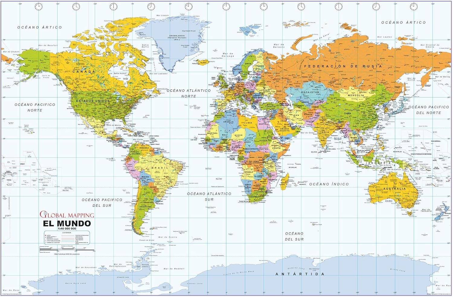 Maps - Political World Wall Map, Spanish Language, Mapa político del mundo, idioma español - 40.75 x 27 inches - Paper - Flat Tubed
 Maps - STAR BUILDERS Solar System and Beyond Map - Spellbinding Space Poster in Tube with All Moons, Planets, Dwarf Planets, Voyager 1 & 2, Interstellar Space, Alpha Centauri and more

Cool Owl Maps Florida State Wall Map Poster Rolled (Laminated 24"Wx25"H)
Maps - Cool Owl Maps Florida State Wall Map Poster Rolled (Laminated 24"Wx25"H)
 Maps - Franko Maps Caribbean Sea Waterproof Map…Franko Maps Caribbean Sea Waterproof Map…Franko Maps Caribbean Sea Waterproof Map…Franko Maps Caribbean Sea Waterproof Map…Franko Maps Caribbean Sea Waterproof Map…Franko Maps Caribbean Sea Waterproof Map…Franko Maps Caribbean Sea Waterproof Map…Franko Maps Caribbean Sea Waterproof Map…Franko Maps Caribbean Sea Waterproof Map…Franko Maps Caribbean Sea Waterproof Map…

 Maps - HISTORIX Vintage 1933 Long Island NY Map - 18x24 Inch Vintage Map of Long Island Wall Art - Old Long Island Sound Map - History Map of New York Poster - Historic State of New York Map Poster
