
Features
Details
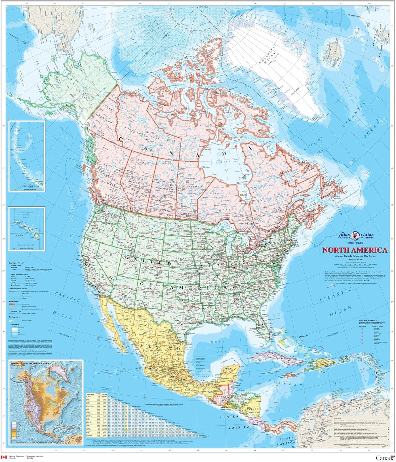
Introducing the North America Wall Map - Atlas of Canada, the perfect addition to your home or office décor. Measuring a sizable 34" x 39" and printed on durable polypropylene material, this map is built to last. Unlike traditional paper maps, our matte finish eliminates glare and adds a sophisticated texture. Whether you're planning a trip, studying geography, or simply want to admire the beauty of North America, this map is ideal for display.
With detailed coverage of populated places, transportation routes, and the drainage network, this general reference map is a wealth of information. Each land area is colored to represent individual countries and dependencies, making it easy to distinguish between regions. Alongside the main map, you'll find three inset maps showcasing the Aleutian Islands (Alaska), Hawaii, and the North America relief with significant mountain elevations. Additionally, a table of road mileages between major cities is included for your convenience.
One of the standout features of this map is its durability. Printed on polypropylene, it is stronger than most papers and unlikely to crease or rip. This ensures that your map will remain intact even with regular use. Please note that this map is not laminated and is not suitable for dry-erase markers. However, the tubed packaging guarantees safe shipping and arrival at your doorstep.
Don't miss out on owning this North America Wall Map - Atlas of Canada. It is not only a functional and educational tool but also a beautiful piece of art that will enhance any space. Click here to order yours today and explore the wonders of North America in stunning detail.
Discover More Best Sellers in Maps
Shop Maps
New Hampshire & Vermont State Wall Map - 25" x 18.5" Paper

 Maps - New Hampshire & Vermont State Wall Map - 25" x 18.5" Paper

Laminated Retro Color Political Map of United States USA Photo Art Print Poster Dry Erase Sign 18x12
 Maps - Laminated Retro Color Political Map of United States USA Photo Art Print Poster Dry Erase Sign 18x12

Cool Owl Maps USA County Wall Map Poster (36"Wx24"H") (Laminated Black/White)
Maps - Cool Owl Maps USA County Wall Map Poster (36"Wx24"H") (Laminated Black/White)

Greater Las Vegas NV Detailed Region Wall Map (55"x44" Laminated)
Maps - Greater Las Vegas NV Detailed Region Wall Map (55"x44" Laminated)
 Maps - Laminated Vintage Map of Europe Travel World Political Map Cities in Detail Map Posters for Wall Map Art Wall Decor Geographical Illustration Tourist Travel Destinations Poster Dry Erase Sign 24x36
 Maps - US National Parks Scratch Off Map - Large Scratch Off National Parks Poster 24"x 17" 62 US National Parks. Gold Foil Featuring Detailed Images. Includes Scratch Off Pen, Pick and Brush

Teacher Created Resources Colorful United States of America Map Chart
Maps - Teacher Created Resources Colorful United States of America Map Chart
 Maps - 24"x28" Heavyweight Quality Poster :: Large scale political map of the Middle East with major cities - 2013 Middle East Asia [Plain Coated Poster]


