

Features
Details
Introducing the Texas Counties - Paper 36" x 36". This meticulously designed map is the ultimate tool for anyone interested in exploring the vast beauty of Texas. Measuring an impressive 36" x 36", it provides a comprehensive overview of the counties, cities, towns, county seats, and MSA's across the Lone Star State. Crafted with precision and printed on heavy 36lb bond paper, this map guarantees unmatched durability and clarity.
Imagine being equipped with the knowledge of each county and its corresponding cities and towns whenever you plan your adventurous road trips through Texas. The Texas Counties - Paper 36" x 36" offers that and more! With a complete index, finding the exact location you're looking for becomes a breeze. Whether you're a nature enthusiast or a history buff, this map will guide you to countless hidden gems and points of interest in the state.
One of the standout features of this map is its mileage chart. Going on a long-haul journey? This handy chart will give you a quick and easy reference for distances between various locations, helping you plan your routes efficiently. No need to rely on GPS alone anymore; the Texas Counties - Paper 36" x 36" ensures you have all the information you need right at your fingertips.
Don't miss out on the opportunity to own this must-have resource for anyone who wants to explore the wonders of Texas. Whether you're a travel enthusiast, a planner, or simply appreciate the beauty of cartography, this map is a treasure worth investing in. Take advantage of this limited-time offer and grab your Texas Counties - Paper 36" x 36" today!
Get your Texas Counties - Paper 36" x 36" now!Discover More Best Sellers in Maps
Shop Maps
Rand McNally Easy to Read: Pennsylvania State Map
 Maps - Rand McNally Easy to Read: Pennsylvania State Map

Maps International Medium Political Middle East Wall Map - Paper - 27 x 33
Maps - Maps International Medium Political Middle East Wall Map - Paper - 27 x 33
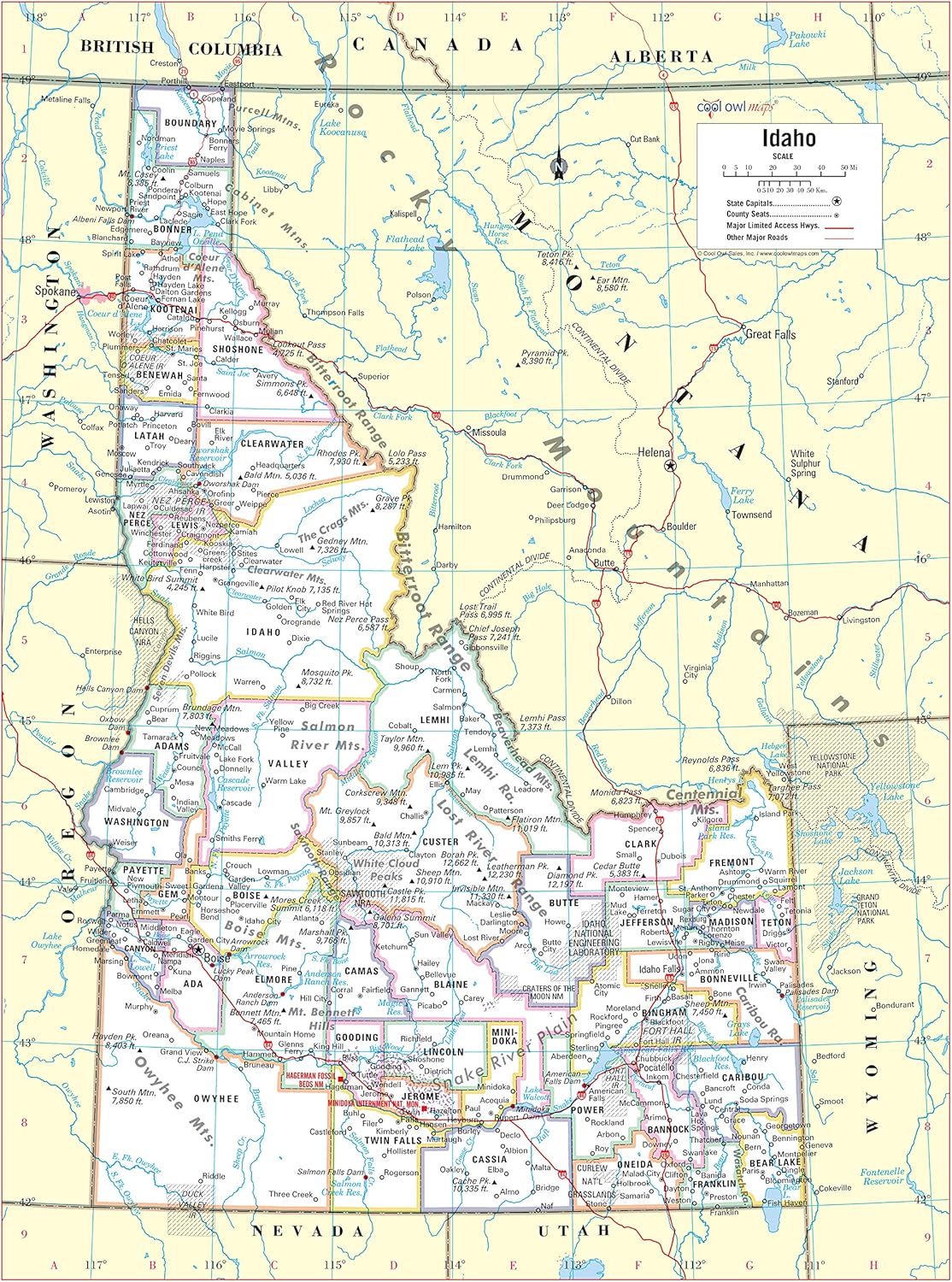
Cool Owl Maps Idaho State Wall Map Poster Rolled 24"Wx32"H (Paper)
Maps - Cool Owl Maps Idaho State Wall Map Poster Rolled 24"Wx32"H (Paper)
 Maps - XL Scratch Off World Map with 233 Flags – 36 x 24 Scratch Off Map of The World + USA Scratch Map – Easy to Frame World Map + Tools – Detailed Travel Wall Poster - Deluxe Gift for Travelers

Phoenix, Arizona Wall Map, Large - 22.75" x 21.5" Laminated
Maps - Phoenix, Arizona Wall Map, Large - 22.75" x 21.5" Laminated
![Maps - 3 Pack - World & USA Maps + Solar System Poster Set [BLUE] (LAMINATED, 18](https://images-na.ssl-images-amazon.com/images/I/91DRKIJzG6L._AC_SL1500_.jpg)
3 Pack - World & USA Maps + Solar System Poster Set [BLUE] (LAMINATED, 18" x 29")
![4.8 of 5 Stars: Maps - 3 Pack - World & USA Maps + Solar System Poster Set [BLUE] (LAMINATED, 18](/images/rate4h.svg) Maps - 3 Pack - World & USA Maps + Solar System Poster Set [BLUE] (LAMINATED, 18" x 29")
Maps - 3 Pack - World & USA Maps + Solar System Poster Set [BLUE] (LAMINATED, 18" x 29")
 Maps - Premium Detailed World Travel Map Pinboard on Canvas | Interactive Travel Map with Pins | Perfect for Marking Your Adventures and Travel Memories | Pin Adventure map (40 x 30)

Dungeons & Dragons The Wild Beyond The Witchlight - Map Set Multi
Maps - Dungeons & Dragons The Wild Beyond The Witchlight - Map Set Multi


