
Features
Regularly updated, full-color maps
Clearly labeled Interstate, U.S., state, and county highways
Indications of parks, points of interest, airports, county boundaries, schools, shopping malls, downtown & vicinity maps
Major attractions and Golf Courses
Easy-to-use legend
Detailed index and Major Street Index
Copyright 2024
Coverage Area Communities Included: Belle Meade, Bellevue, Berry Hill, Brentwood, Forest Hills, Franklin, Goodlettsville, Hendersonville, Lakewood, Lavergne, Mount Juliet, Nolensville, Oak Hill, Smyrna
Discover More Best Sellers in Maps
Shop Maps

 Maps - National Geographic Africa Wall Map - Classic - Laminated (24 x 30.75 in) (National Geographic Reference Map)

Never Split the Difference: Negotiating as if Your Life Depended on It
Maps - Never Split the Difference: Negotiating as if Your Life Depended on It

36x54 Illinois State Official Executive Laminated Wall Map
Maps - 36x54 Illinois State Official Executive Laminated Wall Map

World Wall Map Poster 36"x24" (when unfolded) Paper
 Maps - World Wall Map Poster 36"x24" (when unfolded) Paper

Rand McNally State Maps: New Jersey and New York (2 Maps)
Maps - Rand McNally State Maps: New Jersey and New York (2 Maps)
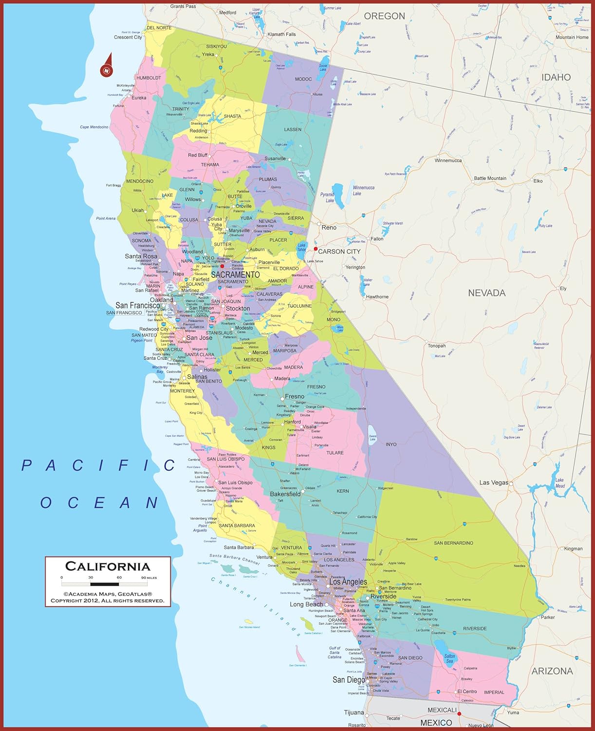 Maps - California State Wall Map | Giant 60x46 Inch Poster with Large, Easy to Read Text | Thick, Durable Lamination - Safe for Use with Wet/Dry Erase Marker

National Geographic: Antarctica Wall Map - 28 x 22 inches - Paper Rolled
Maps - National Geographic: Antarctica Wall Map - 28 x 22 inches - Paper Rolled

Teacher Created Resources Travel the Map Computer Paper, 8.5" x 11", 50 Sheets
Maps - Teacher Created Resources Travel the Map Computer Paper, 8.5" x 11", 50 Sheets

 Maps - Landmass 24" Magnetic Wood Poster Hanger Frame + Scratch Off Map Of The United States - USA Poster Print - US National Parks - America State Capitals - Travel Wall Hanging Art - Decor - Gifts Idea

